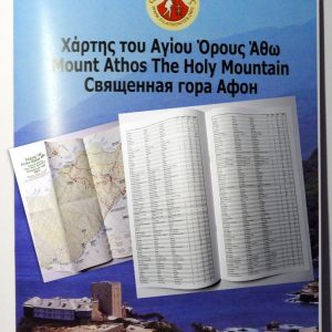
Maps
The maps have been compiled with information from many sources. We have collected hundreds of GPS tracks, which have have been assessed and refined. We have used shape files from the Shuttle Radar Topography Mission of NASA, satellite photographs from the Pleiades Program and public domain pictures.
Additional information has been gained from study of old maps, and conversations with monks on the Holy Mountain. We realise there are gaps in our knowledge. We have established this website to create a forum where the maps can be continually improved. The maps are printed “on demand” so all improvements can be incremental and continuous.
When we started sending out maps, we worked quite hard to get the packed weight of the map less than 200g. This means that it can go at Airmail Letter Rate, which is inexpensive, and does not require Customs Declarations. Our Postal Service quotes delivery times of between 6-10 working days, anywhere in the world. This does not appear to reflect our experience, and these times are often exceeded. There is little we can do about this, and Courier and Parcel Post are very expensive. We share the frustrations that some of you may experience.
Our maps


This September (2025) our office will be closed for a month. We will cease sending out maps on Sunday the 31st of August, and will recommence dispatching them on Monday 6 September. We are sorry but this is unavoidable! Any orders received in the interim will be dispatched on or after Monday, 6 September. One of the issues I will have to resolve is that of price! I am always embarrassed about the prices I charge, but in the face of continual paper, toner, ink, and postage rises, I have to respond. I will do this on our return. I am truly sorry about this.
With very best wishes, and love and respect for the Holy Mountain and the people who live there. Peter